Showing posts with label Tectonics. Show all posts

February 15, 2022

Ex Nihilo VI: Tectonics III

Continuing on with the work of generating terrain from the tectonics. My first fresh crack uses both tectonic uplift and droplet erosion. These processes are cycled over and over until some condition is met. In this case, I start from a flat plane and stop when at least one cell is at its maximum height (25599 ft). The sea level is determined such that 29% of the total surface is land. I also apply a hypsometric curve to the land area so that higher elevations appear in roughly the same proportions that they do on our earth.

However, this algorithm generates a pretty boring topography. The mountains slope up uniformly from the coast, and the tectonic uniquenesses are not presevered. Usable, but disappointing.

The problem is that the erosion cycle is too powerful as the terrain grows from zero, and only the center of the continents (that is, the areas with the least erosion) have any chance of growing at all. To fix this, I began with a terrain generated directly from the relative uplift scaled to max height. The warping effects are clearly visible here but these will be smoothed out by the erosion algorithm.

Next, I again cycle through the erosion, but this time I rescale the height at the end of each cycle and apply the same hypsometric distribution. This yields a much more interesting topography.

The grayscale map is a bit hard to parse, so I threw the map into GIMP and applied a simple colormap. where 10,000 ft begins to turn into gray/white.

There are still some issues I can see, or improvements that can be made. Coastal areas are pretty uniformly low for many hexes inland (no Chilean Andes). Most areas do not have significant mountain ranges, although there is one range similar in size to the Tibetian plateau.

But this is the process. Design, test, repeat. This will be good for now and I'll move on to some other elements of the climate system.

February 4, 2022

Ex Nihilo V: Tectonics II

In the previous iteration, the tectonic plates were generated from a Voronoi algorithm, and thus had very straight edges. Here, I've made those more jagged, which should result in a more interesting coastal topography.

And it does! There is still a good deal of far-too-straight lines, but we can live with some of that. The ripple algorithm, which I'll tackle next, should help.

A bit of Gaussian blur:

Next, to closer approximate real-world distributions, I'll apply my hypsometric scaling.

Lastly, to get a feel for how this will shake out, I use the uplift values to generate a quick and dirty initial altitude map. The coastlines are a bit blobby, but I'm happy with this part of the process.

Getting the ripple algorithm to work will be my next order of business.

January 18, 2022

Ex Nihilo IV: Tectonics I

My previous work involved manually drawing out the tectonic boundaries. With the advantage of distance, I'm no longer married to that concept. Instead, we can generate them from scratch.

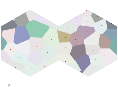
To approximate an irregular but blue-noised grid, I'll grab a Poisson Disk Sample from all points on the map. This is a pretty useful algorithm to know, so it's a good chance to rewrite it to be a bit more efficient. After generating the points, tectonic plates are generated as a Voronoi map with the Poisson Disks as the centers (the shapes it generates are too uniform, so I'll revisit that later). A Poisson radius of 100 hexes yields 36 centers and the following map. Oceanic plates (approximately % of the total area, close to Earth) are shown in a lighter shade.

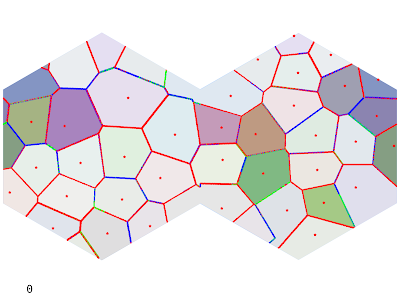
Each plate is assigned a random Euler pole and angular rate of rotation. I can use this to find the strength of collision at each boundary. I'm not super satisfied with the equations I'm using but they can always be modified.

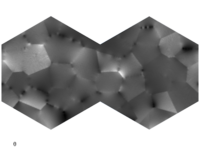
Next, the rate of tectonic uplift for a given hex is determined by each fault's effect on that hex, with a bonus for continental plates (which are lighter and tend to "float"). High uplift values will generate mountains and island chains.

In the past I've played around with various combinations of Perlin noise, domain warping, and other forms of distortion applied to the uplift map to get interesting topographies. The final topography is heavily dependent on the uplift value: the droplet model algorithm gives interesting local topography but is ultimately overpowered by the underlying uplift. So it's important to get it mostly right to begin with. That being said, I find it important not to get too caught up in fine details when there is underlying code to fix. And there is a lot of code to fix and refactor.

To get a rough idea of the kinds of terrain this will generate, we can mock up the elevation values from uplift (essentially scaling from 0 to our max height 25599) and apply a sea height of whatever makes the land percentage 29%. I changed the continents slightly from the plate image above.

Note how straight the lines are, something that will need to be fixed.

The elevation generator is quite slow (particularly given the size of the map), and so it may be a while before I have this round of kinks worked through. My basic algorithm is a droplet model which erodes land based on the tectonic uplift, water erosion, sediment deposition, and coastal erosion. In the past I have used the Wei-Zhou-Dong algorithm for depression filling (which makes all rivers flow to the sea), but I am not terribly pleased with it this time around. We'll see.