
I really like Welsh Piper's hex generation mechanism so I'll be borrowing some thoughts from here. For now, I'll just define a primary type, a secondary type, and a settled type.
Sometimes, settled will be the same color as unsettled. For example, the halflings, who live in icy terrain, wouldn't be able to grow cropland. In this case, I'll define something like settled = primary, where ice is primary and rock is secondary. So the settled areas are still delineated.
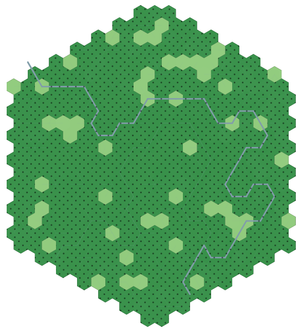
However, most of my test cases right now are in forested areas, so I'll concentrate on those. All those areas turn into grassland type when settled, at least in terms of display. I've also put a pattern over the wild 1-hexes to visually differentiate them if the secondary type is also grassland.
 |
| Blitpsy, population 4976, infrastructure 84 |
I also implemented a condition where the highest infrastructure hex must be on a river. This ensures that a settlement (when I get around to placing them) will always have access to the river.
 | |
|
Speaking of rivers and colors, I'm not sure the river stands out enough. I also kind of want to make the river a bit more fractalized, but I remember that I'm making a representation, a symbolic map, not a literal terrain map.
It does seem that the heightmap (which is shown by lightning the hex the higher you go) is almost invisible. That's fine; it'll mostly be important for determining the rivers and roads.
To do: roads, coastal 20-hexes, and river sources.
No comments:
Post a Comment