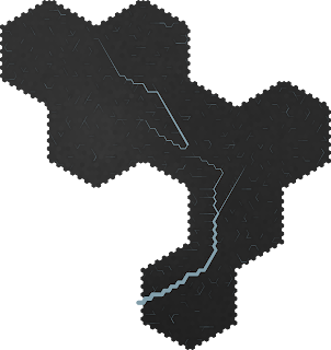
This is really complex project. The main issue is getting each chunk of 1hexes to match with the 20hex from the world map, in terms of the connective data like river flow, terrain at the edges, etc.
Each 20hex is made up of 400 1hexes. Getting raw heighmaps is easy enough. I just use an inverse distance weighting between all of the 20hex neighbors, then add noise until the total average is reasonably close to the 20hex height average.
 |
| Hex 13 from the Demoland Master Map |
Thats a lot of basins! I would like most of them to pull together to a single exit hex. Each hex always has 0 or 1 river exits. Hex 13 happens to not have any rivers flowing into it; I picked it because I only want to worry about one new issue at a time. With a little playing around with the heights, I can get the following:
However, it takes a few minutes to run this particular code: I'll adjust the height of a basin, check the drainage pattern, and repeat until I've worked that number down to a point I like. The result looks good, but ends up messing with the average value too much. Sometimes, it's almost impossible to find a good network.
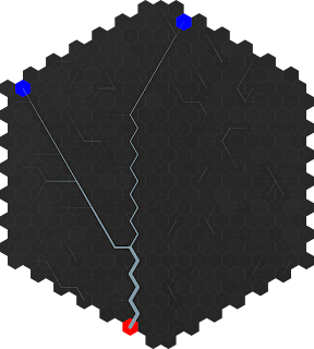
When rivers flow in and out, it gets even more complicated. I want to be able to put these together like puzzle pieces, so that means saving the entrance and exit hexes so I can use them again later if I want. But to ensure a consistent flow, I have to cheat again.
 |
| Hex 14, river sizes exaggerated |
Explicitly connecting the drainage hexes together like this might actually end up being better in the long run; better than the height adjustment from above. I'd like to add some of the erosion code (or something similar) to give more realistic topography.
 |
| Why is there a little break there?? |
So I need to fix my A* and work on erosion. I wonder if a simple flood fill path-finder wouldn't work better for connecting source and drain. It'd be less efficient, but then again, a winding path would look much better.
I'll probably put this back on the shelf and tackle the remaining issues with the world map generator. However, that's nearing a stage where it'll mostly be research for the trade system, at least to a point where I can get a game up and running.


No comments:
Post a Comment